1.     Physical Environment

o    Physical map of Western Europe

o    Physical map of Germany

o    Physical map of the Netherlands

2.     Weather & Climate

o    Climate map of Western Europe

o    Time of Sun in Germany

o    Precipitation of Amsterdam

3.     Human Environment

o    Pop. Density of Germany

o    Pop. Density of Amsterdam

o    Purchasing Power of Europe

4.     Road maps

o    Autobahn map

o    Netherlands travel map

o    Amsterdam map

5.     City Maps

o    Frankfurt City Map

o    Frankfurt City Map (2)

o    Amsterdam City Msp

6.     Urban Transportation Maps

o    Subway map for Frankfurt

o    Bus map for Amsterdam

o    Subway map for the Netherlands

7.     Tourist Maps

o    Tourist map guide in Frankfurt

o    Tourist map guide in Amsterdam

o    Central Berlin plaza


1 Physical Environment

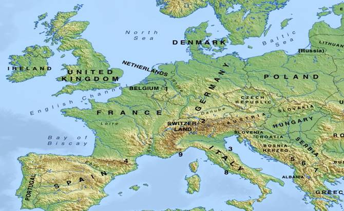
Physical Map of Western Europe. This broad map I chose due to its clearness of showing the landscape over the entire region.

https://www.google.com/search?rlz=1C1AVFC_enUS799US799&q=western+europe+physical+map&tbm=isch&source=univ&sa=X&ved=2ahUKEwjapKuw_-HgAhUE1qwKHTbUC5EQsAR6BAgBEAE&biw=1344&bih=730#imgrc=zgAaBuoxthWJIM:

Image result for western europe physical map


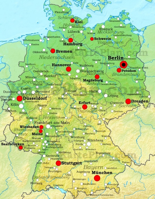
Physical Map of Germany. I chose this map because it is aesthetically pleasing with the colors and shows the major cities well.

http://ontheworldmap.com/germany/germany-physical-map.html

Germany physical map


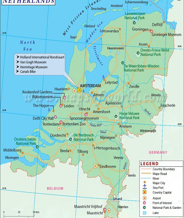
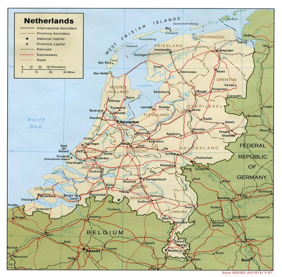
Physical map of the Netherlands. This is a great physical map because it has several icons of different physical parts of the country. It also shows you in the lower lefthand corner the measurement across the country in Kilometers which is good to know the distance between cities and landscapes of the Netherlands.

 https://www.google.com/search?rlz=1C1AVFC_enUS799US799&biw=1344&bih=730&tbm=isch&sa=1&ei=47V5XPC0HNC2sAWPs7eAAQ&q=physical+map+of+netherlands&oq=physical+map+of+nether&gs_l=img.3.0.0.257020.259473..260691...0.0..1.354.1845.8j2j2j1......1....1..gws-wiz-img.......0i67j0i8i30j0i24.uFmAMH_dY0I#imgrc=41evlgd20T6biM:

Image result for physical map of netherlands

2 Weather & Climate

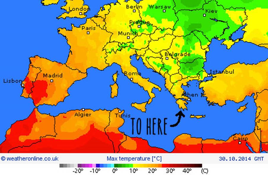
Weather map of the region as a whole. I chose this because it looks accurate and tells me the rough expectation of what to expect from the region at large. The Temperature ranges around 10 and 20 degrees Celsius on the designated areas of travel (Frankfurt, Germany and the Netherlands)

https://weather.com/en-GB/unitedkingdom/weather/video/europe-weather-heatwave-latest-five-day-temperature-forecast-holiday

Image result for weather map of western europe


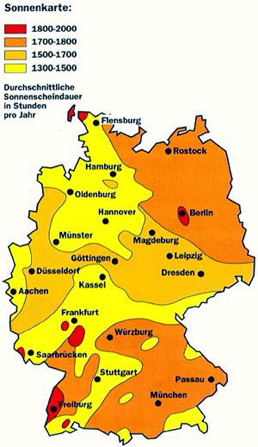
Sunlight exposure Germany sees. The word Sonnenkarte is translated in English for sunshine. And the durchschnittliche sonnenscheindauer in stunden pro jahr translates to sunshine hours per year.

https://www.google.com/search?biw=1344&bih=730&tbm=isch&sa=1&ei=Pbp5XJGnNc6usAWv5JT4Dg&q=weather+map+of+germany&oq=weather+map+of+germany&gs_l=img.3...0.0..40314...0.0..0.0.0.......1......gws-wiz-img.rn7GZtkJzhE#imgrc=nYh6o8LA767LRM:

Image result for weather map of germany

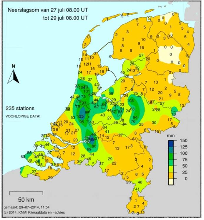
Precipitation map of the Netherlands. Due to a lot of rain I thought it would be wise to know which parts of the country get the most rainfall. Good news for me Amsterdam is just North of where they get the most rainfall.

https://www.google.com/search?biw=1344&bih=730&tbm=isch&sa=1&ei=Pbp5XJGnNc6usAWv5JT4Dg&q=weather+map+of+the+netherlands&oq=weather+map+of+the+netherlands&gs_l=img.3...2724.7147..7331...0.0..0.155.1871.17j5......1....1..gws-wiz-img.......0j0i67j0i8i30j0i24.28k842WVLsk#imgrc=VWlw2b0RJLC9EM:

Image result for weather map of the netherlands

3 Human Environment

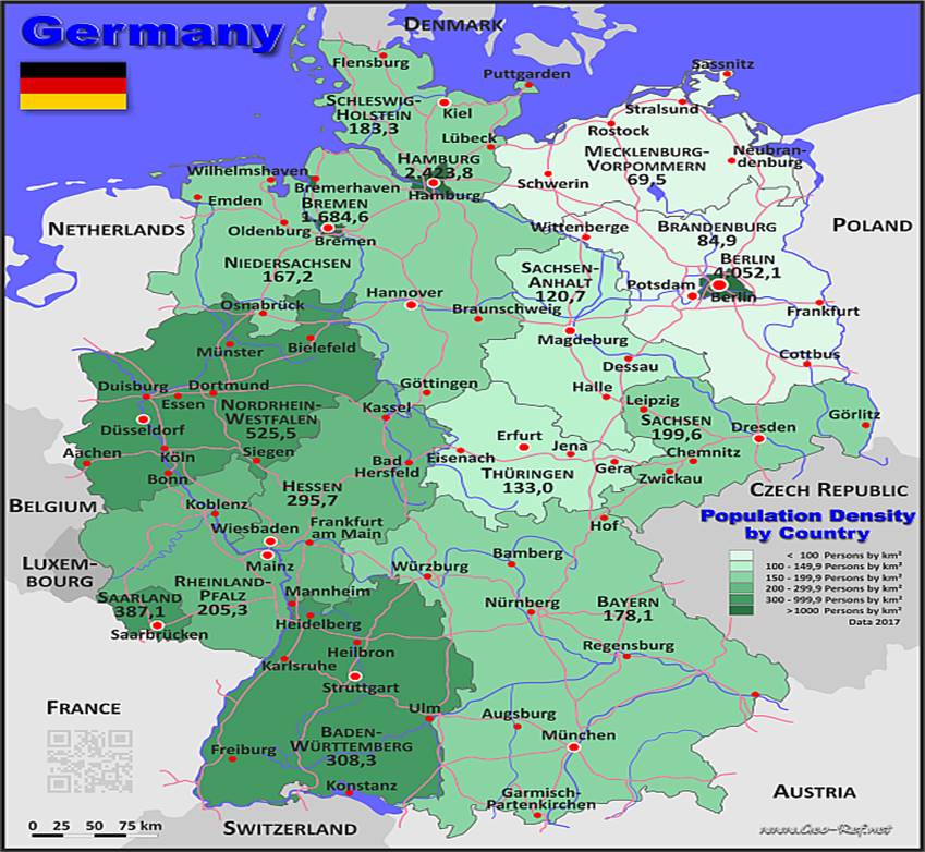
Population pattern and density in Germany. Frankfurt to my surprise is not as populous as I thought as it is the lighter shade of green with around 200,000 people per square Kilometer. Germany is known for its smaller population despite its developed nation status.

https://www.google.com/search?biw=1344&bih=730&tbm=isch&sa=1&ei=Pbp5XJGnNc6usAWv5JT4Dg&q=population+density+map+in+germany&oq=population+density+map+in+germany&gs_l=img.3...2706.8584..8856...0.0..0.122.3481.3j30......1....1..gws-wiz-img.......0j0i67j0i8i30j0i24.qpr6zRh76lo#imgrc=xDFSEcG9XrAILM:

Image result for population density map in germany

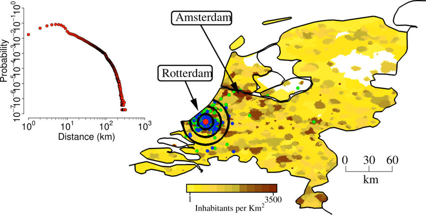
Population density map of Amsterdam to my surprise Rotterdam significantly more populous than the capital. But the yellow on the map indicates increasing population densities in the future. Aside from Rotterdam and Amsterdam the population density is extremely off balance and fragmented across the country.

https://www.google.com/search?biw=1344&bih=730&tbm=isch&sa=1&ei=Pbp5XJGnNc6usAWv5JT4Dg&q=population+density+of+the+netherlands&oq=population+density+of+the+netherlands&gs_l=img.3..0j0i8i30j0i24.2501.14179..14380...0.0..0.130.4128.0j37......1....1..gws-wiz-img.......0i67.Ecy5RCN1WCg#imgrc=yKKppE47Op8UoM:

Image result for population density of the netherlands

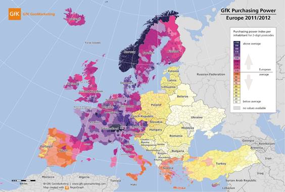
The “Purchasing Power of Europe” This map displays the amount of money throughout the region of Europe. In my area of travel. Both Germany and the Netherlands are in the violet color which signifies they are right above the average of purchasing power. Norway was a bit surprise to me as they and Switzerland are the highest in the region. But it should not surprise as they both have had had relatively high GDP over the years.

https://www.google.com/search?rlz=1C1AVFC_enUS799US799&biw=1344&bih=730&tbm=isch&sa=1&ei=6LZ5XJylO4XUtQX99auoCw&q=income+map+of+Europe&oq=income+map+of+Europe&gs_l=img.3...2464840.2470517..2470638...0.0..0.113.2085.4j16......1....1..gws-wiz-img.......0j0i67j0i8i30j0i24.LGo_ltrvSOc#imgdii=vUzcoJZFnPxqVM:&imgrc=mX5LBjz-iTdmsM:

Related image

4 Road Maps

The Autobahn is one of the fastest streets in the world that is Germany’s interstate.

https://www.google.com/search?rlz=1C1AVFC_enUS799US799&biw=1344&bih=730&tbm=isch&sa=1&ei=TcR5XI_BOdb9-gTGmaWIBw&q=autobahn+germany+map&oq=autobahn+germany+map&gs_l=img.3..0j0i8i30.3799.6564..6815...0.0..0.106.1761.14j4......1....1..gws-wiz-img.......0i24j0i30.WzErdFl--eE#imgrc=X6HBuju4b5_LPM:

Image result for autobahn germany map

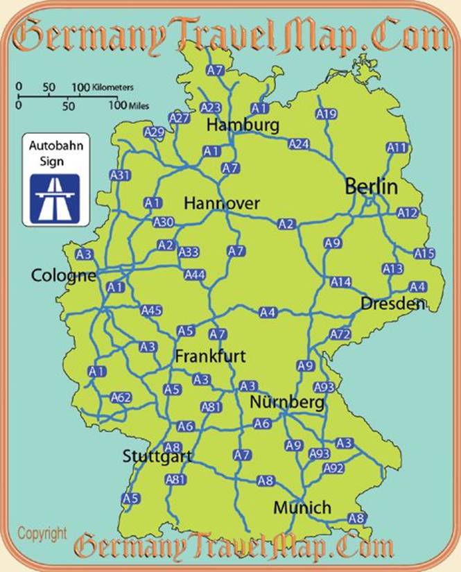
Several different boundaries are shown in the map, it also shows several ways to travel throughout the country. I would probably use the expressway the most but it is nice having a backup plan for travel just in case.

https://www.google.com/search?q=the+netherlands+road+map&rlz=1C1AVFC_enUS799US799&source=lnms&tbm=isch&sa=X&ved=0ahUKEwiDssfol-LgAhWJJzQIHVWrCvIQ_AUIDigB&biw=1344&bih=730#imgrc=OqJU_ad4u-hzzM:

Image result for the netherlands road map

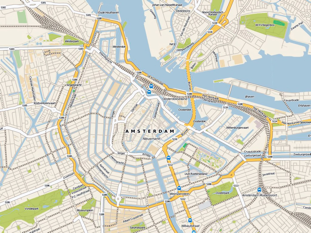
A more detailed and intricate map of Amsterdam’s roads and layout. I chose this map because it is very clear and also shows several parks and places to go. It is also very convenient for travel as there are several bus stations around.

https://www.google.com/search?q=amsterdam+road+maps&rlz=1C1AVFC_enUS799US799&source=lnms&tbm=isch&sa=X&ved=0ahUKEwidu7romOLgAhWEJDQIHX5LBBgQ_AUIDygC&biw=1344&bih=730#imgrc=1s8_PStoOFn7wM:

Image result for amsterdam road maps

5 City Maps

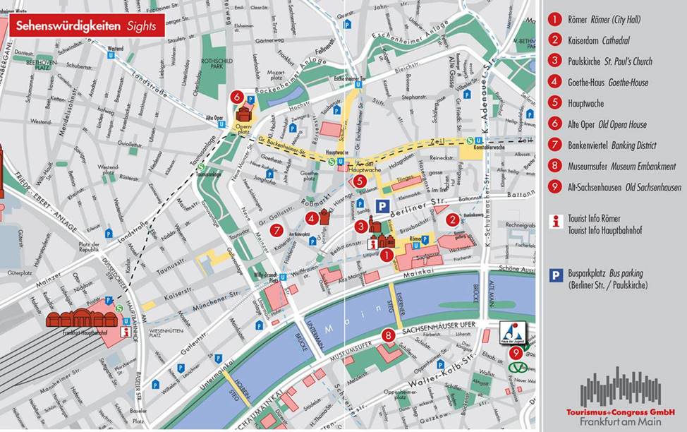
Frankfurt city map shows several hot spots for tourist attractions in red

https://www.google.com/search?q=frankfurt+city+map&rlz=1C1AVFC_enUS799US799&source=lnms&tbm=isch&sa=X&ved=0ahUKEwiJpZTWmeLgAhWwJzQIHbVIBJIQ_AUIDigB&biw=1344&bih=730#imgrc=bTD4-QhJSkLWwM:

Image result for frankfurt city map

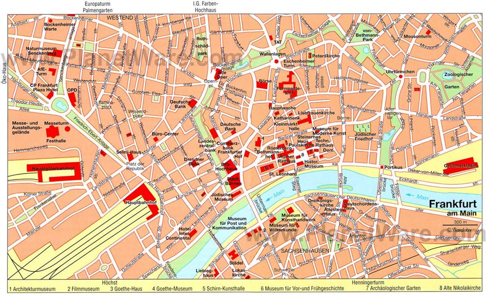
In comparison to the Frankfurt map above. I actually like the second one better because it is a little more clear than the first one I found, and it specifically tells what attractions are around. Both are useful but I would prefer to use the second one.

 https://www.google.com/search?q=frankfurt+city+map&rlz=1C1AVFC_enUS799US799&source=lnms&tbm=isch&sa=X&ved=0ahUKEwiJpZTWmeLgAhWwJzQIHbVIBJIQ_AUIDigB&biw=1344&bih=730#imgrc=WpvYlilhYUXLKM:

Image result for frankfurt city map

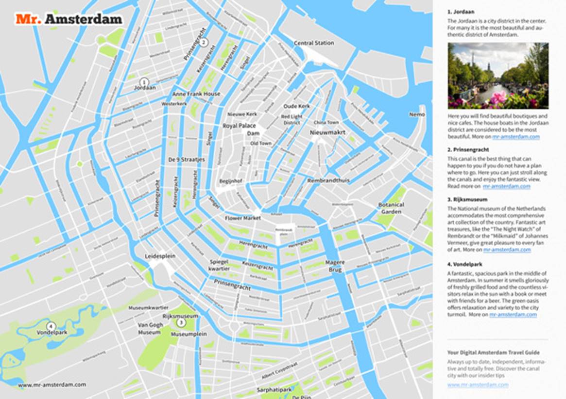
City layout map of Amsterdam shows several canals and waterways that surround the city.

https://www.mr-amsterdam.com/info-amsterdam-tourist-city-map-pdf.htm

https://www.mr-amsterdam.com/media/images/info/amsterdam-map/mr-amsterdam-map-pdf-offline.jpg

6 Urban Transportation

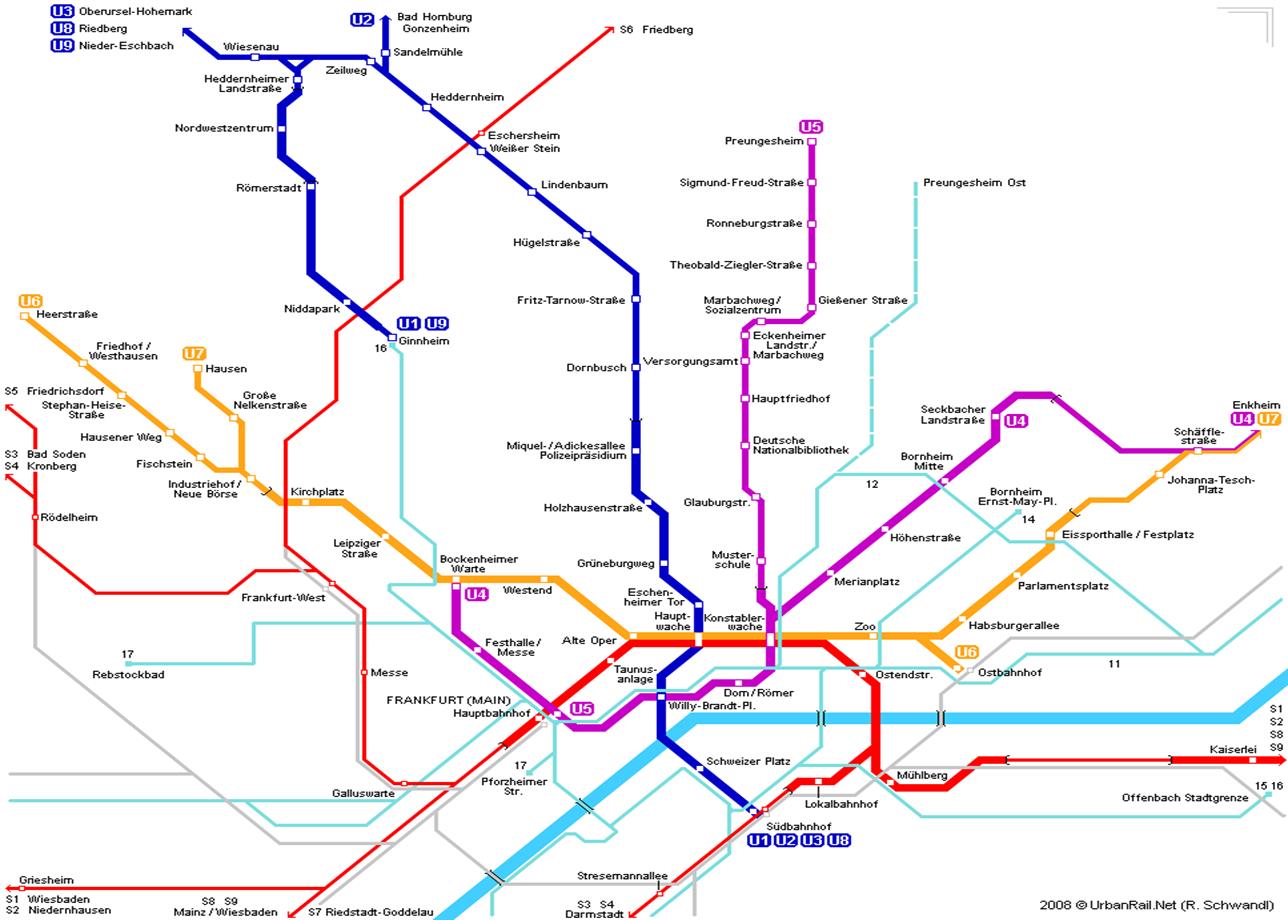
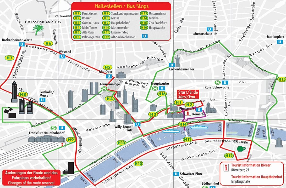
This is a subway map throughout Frankfurt. I had a difficult time finding a clear one but this map was the most clear to me. It displays the route clearly as well as the layout of the city my other maps showed me.

https://www.google.com/search?q=frankfurt+subway+map&hl=en&authuser=0&rlz=1C1AVFC_enUS799US799&tbm=isch&source=iu&ictx=1&fir=SgFhUBIUGOAgpM%253A%252CLDNThmfmO2wiPM%252C_&usg=AI4_-kSdZkyJBEmoxDFc_QMNTWSHmk_5sg&sa=X&sqi=2&ved=2ahUKEwj9q4W7nOLgAhXpoYsKHXskB3IQ9QEwAHoECAQQBA#imgrc=SgFhUBIUGOAgpM:

Image result for frankfurt subway map


This is a bus tour guide of Amsterdam. This looks very convenient in the way it is layed out. I would use this because it has several different stops at many different sites.

https://www.google.com/search?q=amsterdam+bus+map&hl=en&authuser=0&rlz=1C1AVFC_enUS799US799&source=lnms&tbm=isch&sa=X&ved=0ahUKEwjeo4LBn-LgAhWEKn0KHTgCCnoQ_AUIDygC&biw=1344&bih=730#imgrc=AQHj_uMvrM2sHM:

Image result for amsterdam bus map


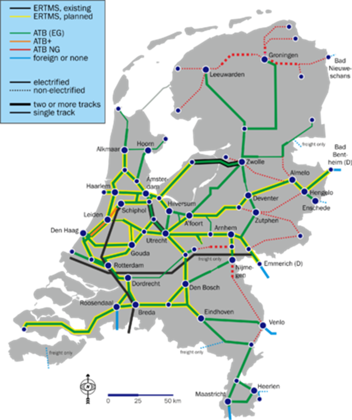
Another helpful map to travel through the Netherlands would be this train map. The blue dots show where each station will go. I chose this train map because it is extremely transparent and easy to read.

 https://www.google.com/search?q=netherlands+train+map&hl=en&authuser=0&rlz=1C1AVFC_enUS799US799&source=lnms&tbm=isch&sa=X&ved=0ahUKEwj8-MOoo-LgAhV0KH0KHf3XDXMQ_AUIDygC&biw=1344&bih=730#imgrc=fXoUn_xBvGgozM:

Image result for netherlands train map

7 Tourist Sites

This tourist map shows several interesting places to travel all through Frankfurt. I would definitely be interested in going on this guide. It is very easy to see every stop you are going at, and have many different and interesting places to see.

https://www.google.com/search?q=frankfurt+tourist+site&hl=en&authuser=0&rlz=1C1AVFC_enUS799US799&source=lnms&tbm=isch&sa=X&ved=0ahUKEwiyuPbMpuLgAhVxIDQIHUM5DboQ_AUIECgD&biw=1344&bih=730#imgrc=msrqTYIUHzDsoM:

Image result for tourist sites in frankfurt

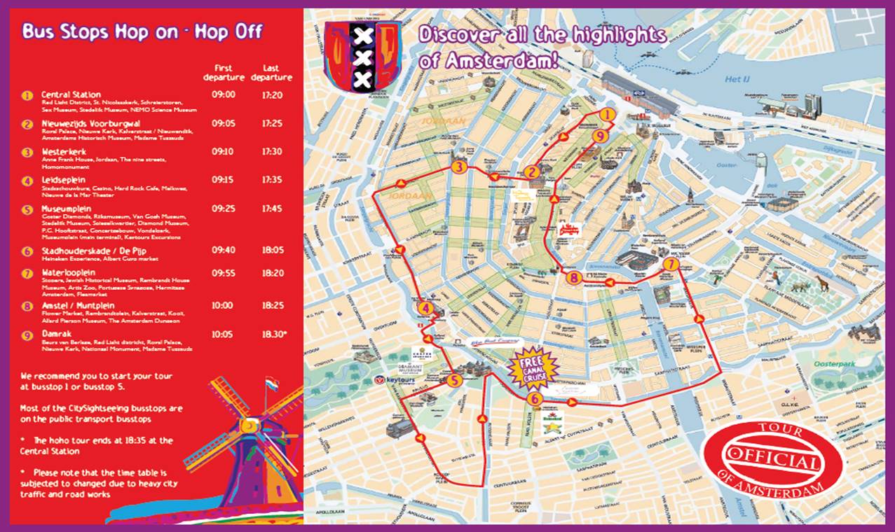
Just like the tour in Frankfurt, but this is the official tour in Amsterdam. There are nine spots to stop including a free canal cruise which I think would be my favorite part of the tour.

https://www.google.com/search?q=amsterdam+tourist+sites&rlz=1C1AVFC_enUS799US799&source=lnms&tbm=isch&sa=X&ved=0ahUKEwjZqbTJqOLgAhUnFjQIHQz4DKIQ_AUIDygC&biw=1344&bih=730#imgrc=AQHj_uMvrM2sHM:

Image result for amsterdam tourist sites

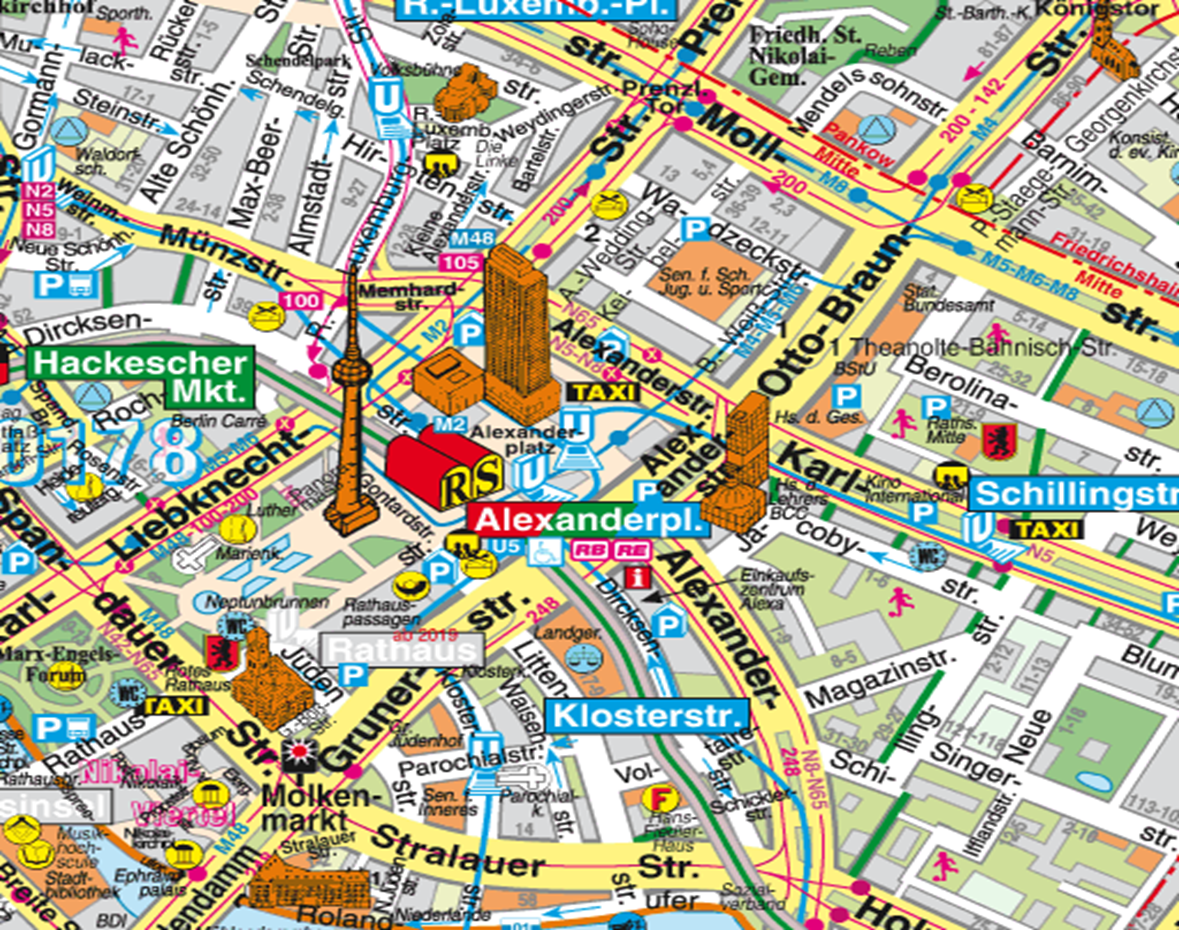
Central Berlin has many things to check out in such a small cluster but I would want to check out Hackescher market as I have been told it is one of the most interesting night places to check out.

https://www.google.com/search?rlz=1C1AVFC_enUS799US799&biw=1344&bih=730&tbm=isch&sa=1&ei=e-N5XJTxDM-X-gTI-4m4CA&q=tourist+map+in+berlin&oq=tourist+map+in+berlin&gs_l=img.3...6913.10279..10527...0.0..0.168.2356.0j21......1....1..gws-wiz-img.......0i67j0j0i8i30j0i24.uPVYiuNwISY#imgrc=7IqSjuJ-TtDTqM:

Image result for tourist map in berlin


Submitted by [Roger Linn] on [3-1-2019].